

These images are different map projections, including conformal map projections, equal-area map projections, and equidistant map projections. Map projections are important because it is very inconvenient to carry around a 3-D globe in your pocket, so geographers convert the 3-D globe into a 2-D paper form. These 2-D projections are called map projections that are able to fit easily in someone's pocket. Map projections are necessary to make maps for people who use them for such purposes as navigation.
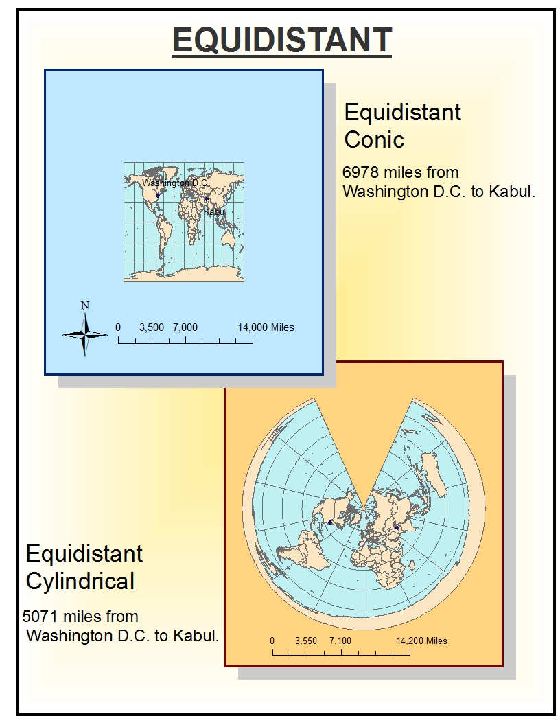
These images show three different map projections: conformal, equal-area, and equidistant. There are two types of conformal map projections displayed here, which include Mercator and Gall Stereographic. For the equal-area map projection I have displayed the Mollweide and Bonne maps. Lastly, for the equidistant map projections I have included the equidistant conic and the equidistant cylindrical. Conformal preserves angels locally, the equal-area preserves the area, and the equidistant preserves distance from some standard point or line.
When creating map projections there will always be distortions because of the the geometry of transforming a 3-D object to two dimensions. One evident problems is that distances are not uniform over all the different map projections. While one map said Washington D.C. was about 7000 miles from Kabul, the other said it was 10,000 miles away. Another problem is that some regions will seem larger in area that others when in reality they are much smaller. Also, some maps will seem as though some regions are not oriented in the directions they are truly oriented and it will seem a bit confusing.
Nonetheless, these maps are extremely useful. They have the potential to be combined to be able to make up for errors that can be lost in distortion. Also, the maps use such elements as angle to show projections so we can use multiple angles to get the correct image. Map projections have many potentials including the ability to be manipulated by geographers to achieve a desired goal using ArcMap.
No comments:
Post a Comment